Cave exploration, commonly called caving or speleology, involves entering and studying natural underground spaces
limestone caves, sandstone caves, lava tubes, and karst systems. Depending on the location, an exploration may involve walking, crawling, climbing, navigating underground streams, or surveying passages.
Caves are formed over very long periods through processes involving water, rock, erosion, mineral deposition, and geological movement. They can contain unusual rock formations, underground rivers, fossils, microorganisms, bats, fish, and other species adapted to dark environments.
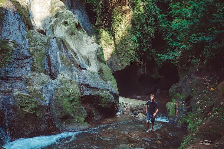
In India, Meghalaya is particularly important for cave exploration because of its extensive limestone and sandstone cave systems. The state includes well-known sites such as Mawsmai Cave, Siju Cave, Krem Puri, Arwah Cave, and Krem Lait Prah. Meghalaya Tourism describes cave exploration as one of the state's major adventure and nature activities.
For beginners, cave exploration is not simply about entering a dark passage. It combines outdoor preparation, navigation, environmental awareness, physical fitness, and careful risk management.
Why Cave Exploration Matters
Cave exploration has value beyond adventure. Caves are natural records of geological and environmental history, and their underground ecosystems can provide information that is difficult to obtain from surface environments.
Exploration can contribute to several areas:
- Geology: Cave formations can reveal how water and rock interacted over long periods.
- Climate research: Deposits such as stalagmites can preserve evidence of past environmental and rainfall conditions.
- Biodiversity research: Caves may contain bats, insects, fish, microorganisms, and other specialized organisms.
- Hydrology: Underground passages can help researchers understand groundwater movement.
- Cartography: Surveying previously unmapped passages expands knowledge of underground landscapes.
- Education: Caves provide practical examples of geological and ecological processes.
- Conservation: Mapping and documentation can help identify fragile environments that need protection.
Cave exploration can also help local communities understand the scientific and cultural importance of underground landscapes. Meghalaya's tourism guidance emphasizes responsible travel, respect for local traditions, protection of wildlife, and minimizing environmental disturbance.
The activity affects several groups, including recreational explorers, geologists, environmental researchers, photographers, conservation organizations, local communities, and tourism authorities.
The main problems it helps address are incomplete geological records, poorly documented cave systems, limited knowledge of underground biodiversity, and the potential loss of fragile cave features through careless human activity.
Recent Developments in Cave Exploration
Meghalaya remained a major focus of Indian cave exploration during 2025 and 2026.
The 2025 Caving in the Abode of the Clouds Expedition was conducted from February 2 to February 28, 2025. A multinational team explored areas in East Khasi Hills and East Jaintia Hills and mapped 22,663 metres of previously unexplored cave passages. Reports published in March 2025 said the work brought the total cave passage explored under the long-running project to more than 573 kilometres.
One important finding was Lungchung Khur, measured at approximately 13.6 kilometres during the expedition. It was reported as India's 10th-longest cave at that time. The expedition also recorded additional caves and underground passages in the Byrong and Jongria areas.
The expedition produced scientific observations as well. Reports from March 2025 described the discovery of four specimens of blind cave fish during the exploration. Such findings demonstrate why caves can be important biological research environments rather than simply adventure destinations.
Further reporting in March 2026 highlighted the same 2025 expedition and its 22.663-kilometre mapping achievement, showing the continuing scientific interest in Meghalaya's underground systems.
Cave exploration is also becoming increasingly connected with digital mapping and scientific documentation. Modern expeditions can combine traditional surveying with digital cave-mapping software, geographic information systems, photography, and three-dimensional modelling.
| Exploration area | Main purpose | Typical information recorded |
|---|---|---|
| Geological survey | Understand cave formation | Rock type, formations, passages |
| Cave mapping | Create accurate underground maps | Distance, direction, elevation |
| Biodiversity survey | Document cave life | Bats, fish, insects, microorganisms |
| Hydrological study | Understand underground water | Streams, pools, drainage routes |
| Conservation survey | Protect sensitive areas | Wildlife, formations, human impact |
Laws and Policies Affecting Cave Exploration in India
There is no single nationwide law that regulates every form of recreational cave exploration. The applicable requirements depend on the location and legal status of the cave.
Caves located inside wildlife sanctuaries, national parks, forest areas, or other protected environments can be subject to environmental and wildlife regulations.
The Wild Life (Protection) Act, 1972 provides a legal framework for protected areas and wildlife conservation. Within sanctuaries, authorities can regulate activities to protect wildlife and habitat. The Act also restricts certain activities and substances that could harm wildlife.
The Van (Sanrakshan Evam Samvardhan) Adhiniyam, 1980, formerly known as the Forest (Conservation) Act, is relevant where forest land and activities affecting forest areas are involved. The legislation and associated rules provide a framework for the conservation and regulated use of forest land.
The Environment (Protection) Act, 1986 provides broader powers for environmental protection and pollution control throughout India. It can become relevant when activities have environmental implications.
Local requirements can also matter. A cave may be located on community-managed, private, forest, wildlife, or otherwise regulated land. Therefore, explorers should check the current requirements with the relevant forest, wildlife, district, tourism, or local authority before entering an unfamiliar cave.
In Meghalaya, responsible exploration is particularly important because many cave systems are associated with forests, rivers, wildlife habitats, and culturally significant landscapes. The state's tourism guidance recommends checking weather conditions, avoiding environmental damage, respecting local traditions, and following local guidance.
Tools and Resources for Cave Exploration
Successful cave exploration depends on preparation as much as physical ability. The exact equipment varies according to the cave, season, depth, water conditions, and technical difficulty.
Important field equipment can include:
- Helmet: Protects the head from low ceilings and falling material.
- Headlamp: Provides hands-free lighting. A backup light is important for underground travel.
- Spare batteries: Lighting systems can fail during long explorations.
- Protective clothing: Helps reduce injuries from sharp rocks, mud, and cold water.
- Appropriate footwear: Good grip is important on wet or uneven surfaces.
- First-aid kit: Useful for dealing with minor injuries.
- Navigation equipment: Compass, GPS receiver, maps, and survey instruments can support route documentation.
- Communication equipment: Appropriate systems can improve coordination during larger expeditions.
- Rope systems: Technical caves may require specialist rope equipment and trained users.
- Survey equipment: Distance, direction, inclination, and elevation measurements can be combined to create cave maps.
Weather information is particularly important in caves containing underground streams. The India Meteorological Department's Mausam platform provides weather warnings, district forecasts, nowcasts, tourism forecasts, and flash-flood information.
For digital mapping, QGIS can be used to visualize and analyze geographical information and create maps. Its current releases also support integration with field-oriented mapping applications.
Therion is another specialized resource. It is designed specifically for cave surveying and can process survey data to create cave maps and three-dimensional models. Its current 6.4.0 release was published in May 2026.
Useful resources include:
- Meghalaya Tourism: Cave locations, seasonal guidance, responsible-travel information, and destination information.
- India Meteorological Department: Weather warnings and forecasts.
- India Code: Official access to central legislation and legal documents.
- QGIS: Geographic information and mapping.
- Therion: Specialized cave-survey and mapping software.
- Local forest and wildlife authorities: Information about access restrictions and protected areas.
- Experienced caving organizations: Training, expedition information, and technical knowledge.
A basic preparation checklist can be organized as follows:
| Preparation | What to check |
|---|---|
| Weather | Rain, thunderstorms, flash-flood risk |
| Route | Entrance, exit, alternative routes |
| Equipment | Lighting, helmet, footwear, first aid |
| Navigation | Map, compass, GPS, survey records |
| Team | Experience and communication plan |
| Environment | Wildlife, fragile formations, local rules |
| Emergency plan | Exit strategy and emergency contacts |
Frequently Asked Questions
What is cave exploration?
Cave exploration is the investigation and study of natural underground spaces. It can include recreational caving, scientific research, surveying, photography, geological study, and biodiversity documentation.
Is cave exploration suitable for beginners?
Some caves have short and relatively accessible sections that may be appropriate for beginners, while others require specialist skills. Mawsmai Cave in Meghalaya, for example, is described by Meghalaya Tourism as an accessible cave experience, while deeper systems such as Krem Lait Prah require considerably greater preparation.
What are the main risks of cave exploration?
Common risks include falls, falling rocks, getting lost, darkness, cold temperatures, flooding, slippery surfaces, exhaustion, and limited communication. Water-filled passages can introduce additional hazards.
Why is Meghalaya important for cave exploration?
Meghalaya contains extensive limestone and sandstone cave systems, including several very long and scientifically significant caves. Continued expeditions have mapped hundreds of kilometres of underground passages and continue to identify previously undocumented areas.
Can anyone enter a cave in India?
Not necessarily. Access depends on the location and legal status of the cave. Protected areas, forest land, wildlife habitats, community-managed areas, and other regulated locations may have specific requirements or restrictions. Checking local rules before entering is essential.
Conclusion
Cave exploration adventures combine outdoor activity, scientific investigation, navigation, geology, biodiversity, and conservation. India's underground landscapes are particularly diverse, with Meghalaya standing out because of its extensive cave networks and continuing exploration.
Recent expeditions show that significant discoveries are still being made. The mapping of more than 22 kilometres of new passages during the 2025 Meghalaya expedition demonstrates how much remains to be documented. At the same time, discoveries such as cave-adapted fish highlight the ecological importance of underground environments.
Responsible exploration requires more than physical preparation. Explorers need reliable lighting, navigation skills, weather awareness, appropriate training, environmental knowledge, and respect for local regulations and communities.